Early on the 3rd August, we lost an hour. We'd crossed into the Mountain Time Zone as we headed into Alberta bound for the tourist honeypot of Jasper. German seemed to be the most common tongue in town! Our friendly ranger the previous night had urged us to visit the Maligne Canyon area of Jasper National Park, so as soon as possible, we headed away from the swarming tourists and souvenir shops to a campground out of town. Once we'd secured our spot at Snaring River Campground, we headed to the canyon to take the hike along its impressive length.
The walk was divided into sections to different bridges across the canyon. By the time we reached bridge five the crowds had really thinned. We decided to take a different route back for variety and to see the view from higher up. High up it certainly was, we huffed and puffed our way up the trail, seeming to climb one foot up for every foot we took forward. We began to understand why, despite the earlier crowds, we had this trail to ourselves!
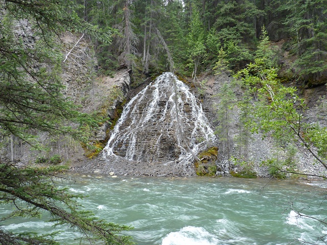
Waterfall
- Maligne Canyon
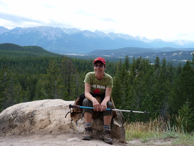
We
made it to the top!
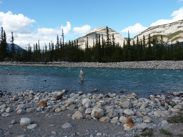
Phil
fishes the Snaring River
By the time we made it back to the campground, Phil had recovered enough energy to try his hand at fishing the river. We wandered up and down the deserted riverbank, under a railroad bridge and quite a way from our campsite. It would have probably been a good idea to take the bear spray, but as normal we forgot. Luckily none of the critters seemed to want to brave the deluge and thunderstorm that caught us on the empty-handed return trip.
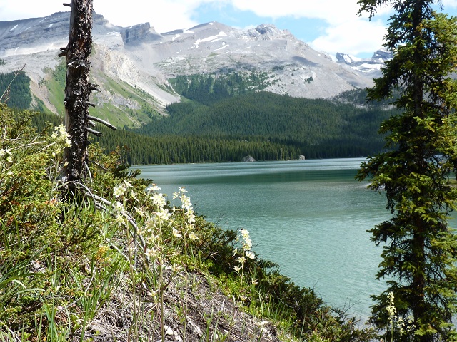
Next day, we drove the 30 mile long, scenic dead-end road down to Maligne Lake, inflated our canoe and set off again in search of Canada's famed fishing. We'd hoped to camp at one of the sites on the lake, until we realised that there was no road, you needed a boat to get there! We had enough trouble fitting all the fishing paraphernalia in our trusty canoe, we'd need a barge to go camping! The stunning scenery and tranquility (at least between battling the wakes of passing tour boats) made the long drive there worthwhile.
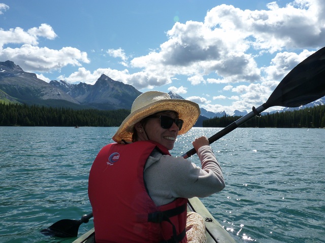
Paddling
Maligne Lake
Maligne
Lake
After a couple of hours of hard paddling, the propulsion officer's arms couldn't take any more. We headed back to shore and took a short hike to Moose Lake. We arrived at the lake, the fisherman excited about the loud splashing we could hear. Perhaps the fish were jumping....perhaps he should have carried his rod on the walk....
It turned out that the lake was called Moose Lake for a reason. The splashing came from a large moose enjoying both a cool dip and a snack of pond weed. We were amazed to watch the large beast totally submerge itself below the surface in search of food. It must have been very tasty pond weed or perhaps a welcome relief from the buzzing mosquitoes.
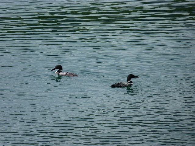
Resident
Loons at Maligne Lake
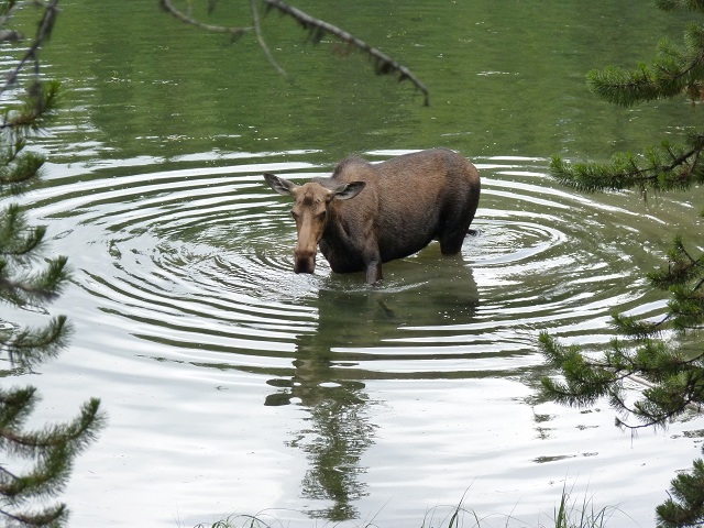
Miss
Moose of Moose Lake
The road between Jasper and Banff National Parks, named the Icefields Parkway, was stunning. Each time you came around a bend, another breath-taking view lay before you. It ran past glaciers and plentiful wildlife. There were deer, bighorn sheep and even a cougar was reported to have been spotted but the main danger on this route seemed to come from the mountain goats. It appeared these unsuspecting animals, grazing along the edge of the roadway, had caused a crash just before we arrived. Well, actually the driver who slammed on the brakes to look at the goats and the car behind, whose driver didn't slam on the brakes but apparently looked at the goats anyway and ran right into the car in front, may actually have been responsible. In the past we'd seen bear jams, elk jams, bison jams, but this was our first goat crash! Luckily no one seemed to be hurt and the goats watch the flashing lights of the emergency vehicles with perhaps just a touch of bemusement glinting in their eyes!
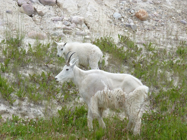
Beware
Dangerous Goats
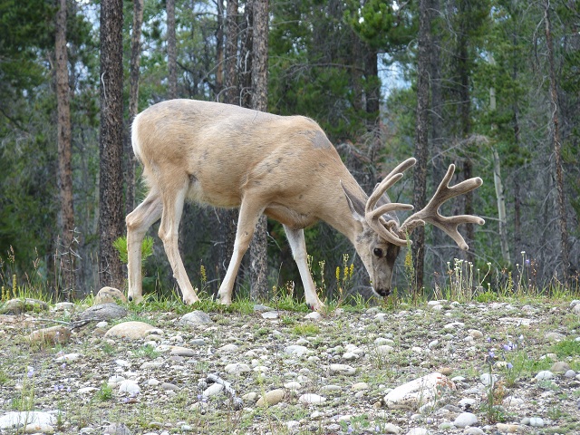
Deer
on the Icefields Parkway
Despite the "Campground Full" sign at the entrance, we decided to check out a campsite near the Columbia Icefield. We were delighted to find it almost completely empty, nobody else seemed to have thought to check. We were glad to have our spot and later, when the rangers remembered to remove the "full" sign, the campground quickly became completely full again.
Having secured our spot, we had plenty of time to explore the nearby Columbia Icefield. As we hiked towards the glacier (or at least what remained of it), we passed signs at regular intervals indicating the dates when the glacier had reached to that point. The global warming induced shrinkage was quite remarkable and somewhat worrying.
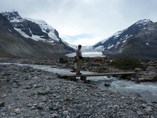
Walking
to the Columbia Icefield
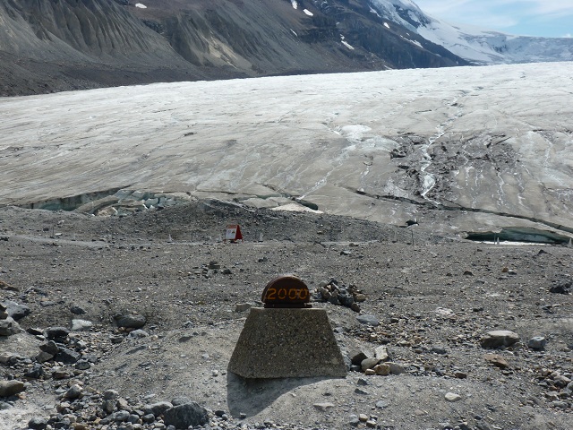
Marker
for the year 2000
This area of Alberta contained four national parks all connected together. The next morning our route south back towards the US border took us out of the Jasper National Park, through part of the Banff National Park and into the Kootenay National Park. All were beautiful.
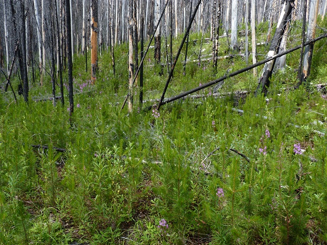
At Kootenay, we took a trail from the beautiful deep and narrow Marble Canyon, a deep trough carved by the clear blue melt water coursing through it. Our hike next took us through an area of forest devastated by fire in 2003. Here the stark contrast between the lush, new, green growth and the burnt and twisted remains of the trees towering was particularly striking, a phoenix rising from the ashes. The trail eventually led to the "Paint Pots" area, where orangey-brown ochre had been mined for paint and dye, initially by the native Indian population and later on a more commercial scale by white settlers.
On
the trail to the "Paint Pots"
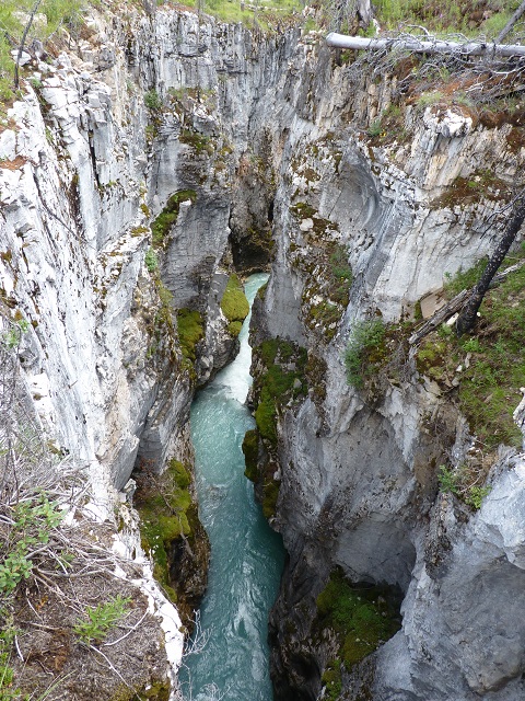
Marble
Canyon
On the last night of our excursion into Canada, we took a campsite at the McLeod Meadows campground in the Kootenay park. Despite our earlier exertions, we were keen to take the walk to Dog Lake. This walk would take us over two bridges crossing different parts of the Kootenay River, we read, and was described as having "no perceptible gain in elevation". This sounded ideal as we were already somewhat weary after our earlier hike but keen to take a look at the lake to scope out the fishing potential. What quickly became apparent was that "no perceptible gain in elevation" in Canadian National Park parlance did not actually mean you didn't have to go up hill. What this trail actually did was make us climb two miles up a steep hillside. At this point, spotting the next section of trail, the penny dropped. "No perceptible gain in elevation" meant you actually dragged yourself up to the top of a really high and steep hill, then to reach the lake you went all the way down again back to the elevation you started from before repeating the whole process on the return trip. At this point we decided climbing the hill once was enough, we turned around and headed back to the river to fish there instead!
Next morning we drove south on route 93 through the literally "gorge-ous" spa town of Radium Hot Springs and eventually found ourselves crossing the border back into the US. This turned out to be our easiest US entry ever, partly because we still had hold of our I-94 visa cards, so no paperwork effort was required by Immigration. Customs was equally simple. Had we purchased anything significant in Canada, which we were bringing back into the US, we were asked. "Have you seen the price of stuff up there?" was our response, at which point the smiling Customs Officer waved us through into Montana.