Central Colorado - Gunnison and Uncompahgre Rivers
22nd - 27th September 2012
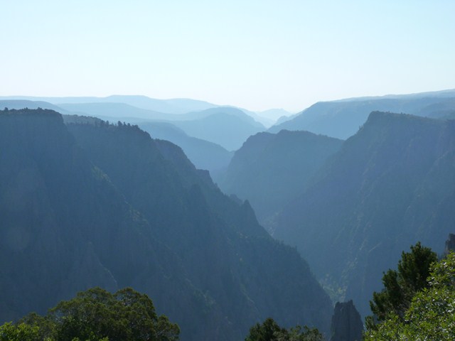
The Black Canyon of the Gunnison, a little heard-of and uncrowded National Park in central Colorado greeted us with stunning, breath-taking and vertigo inducing views from its south rim. The Gunnison River lost an average 96 feet of elevation per mile in the canyon's forty eight mile length, much of the area being accessible only by boat or on foot, creating a wilderness.
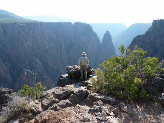
At the highest point, Warner Point, the canyon was 2772 feet deep. In its way, the canyon felt more awe-inspiring even that the Grand Canyon, plunging to such depths in a relatively narrow span between the north and south rims. At each viewpoint, trails led us out onto promontories, giving magnificent vistas along the canyon.
Black
Canyon of the Gunnison National Park
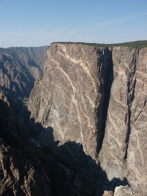
Painted
Wall
A short hike from High Point, the end of the road, took us to Warner Point. From here we had an excellent view of the striking landscape of Colorado south of the Canyon.
The cliffs at Painted Wall, decorated with veins of various different minerals running through it's solid rock, towered twice as high as the Empire State Building.
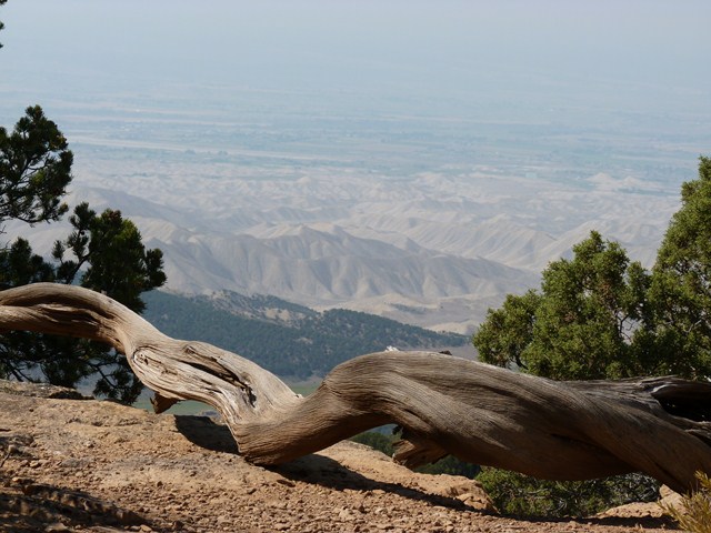
View
from Warner Point
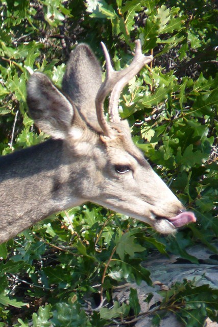
Resident
Deer obviously found something tasty.
After our visit to the National Park, our route through central Colorado took the form of a spider's web, as we circled around to various recommended fishing spots and then on several occasions doubled back to those places we'd particularly enjoyed.
After a night in Montrose "Wally-hopping", our name for camping in Walmart parking lots, we headed to Ridgeway State Park to fish the Uncompahgre River.
We arrived early, yet the river was still crowded with anglers, at least in close proximity to the car park. A short walk along the beautiful riverside trail, led us to unpopulated spots and the river proved to hold plenty of rainbow trout. Using Davy Wotton's wet fly technique, Phil landed over a dozen smallish but nonetheless fierce fish.
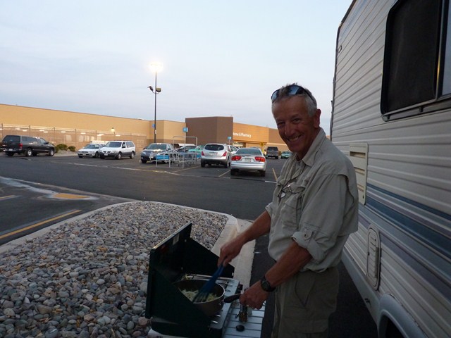
"Wally-hopping"
in Montrose, CO
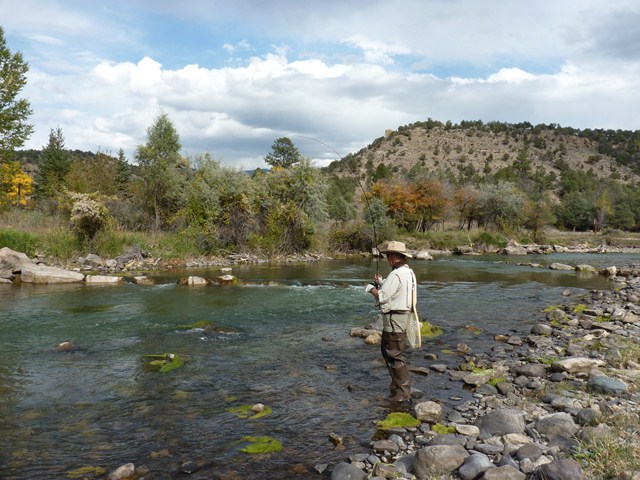
Uncompahgre
River at Ridgeway State Park
Next day we headed back in the direction of the town of Gunnison to the East, returning along the southern rim of the Black Canyon. We made two stops to hike and fish.
Phil
off to fish below Morrow Point
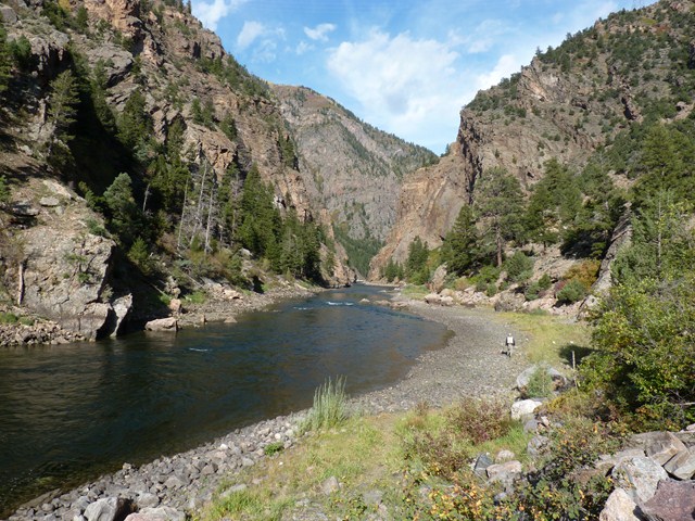
The first was below the Morrow Point Reservoir Dam at Mesa Creek. Here a foot bridge enable us to cross the raging water below the dam and fish from the bank on the north side. Down at river level, we were dwarfed by the huge cliffs of the gorge.
Two rainbow trout later, we moved on eastwards along the Canyon to the area below the Blue Mesa Reservoir dam, Pine Creek Trail. A descent of 232 steps brought us down to river level, where a trail ran along what was once a scenic railroad. It was unbelieveable that engineers managed to construct a railway through the daunting gorge.
Unfortunately the weather turned on us and we took shelter in the covered picnic tables as the rain began to hammer down. Once the thunder and lightning started, it was time to abandon the fishing expedition and make the 232 step climb back to Harvey-the-RV. It was a shame, as the trail at river level was deserted, beautiful and eerily silent.
Pine
Creek Trail below Blue Mesa Dam
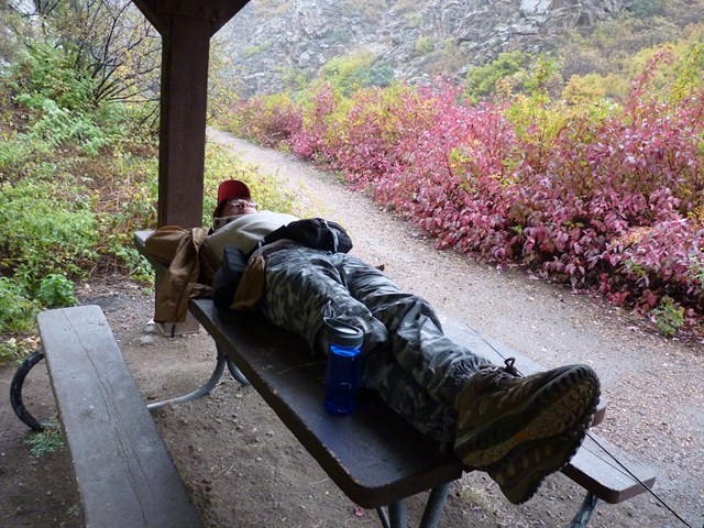
Waiting
for a break in the rain.
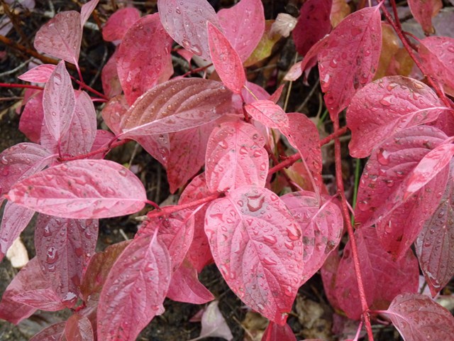
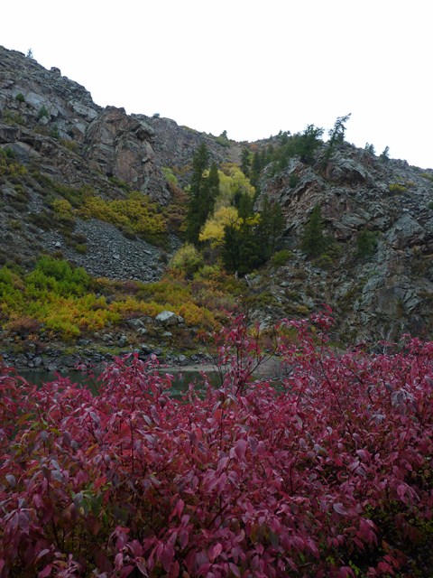
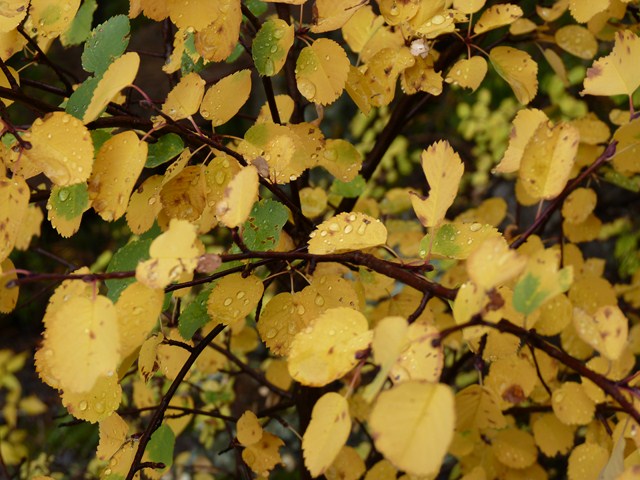
Colorado
living up to it's name.
The area east of the Black Canyon of the Gunnison National Park was designated Curecanti National Recreation Area. More public land, offering a wealth of fishing access spots on the Gunnison River plus a camp ground with the allure of electricity, flush toilets and welcoming rangers, all at a very reasonable rate.
With the drought in the area, the Gunnison was running at a record low level, yet still the fishing was good. We fished a couple of spots on that occasion, near the Lake City bridge and along a trail called "Neversink". Here ironically part of the trail had actually sunk down the river bank.
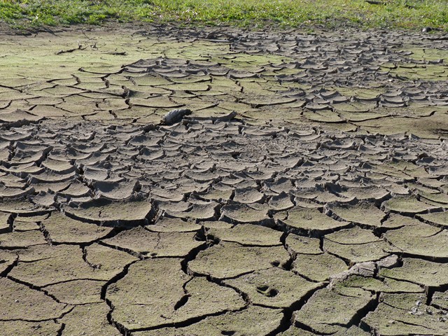
Where
the Gunnison River used to flow.
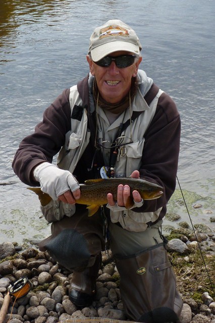
Fishing
the Gunnison at Neversink
The next side trip we'd selected was promising. Our maps showed that the length of the Taylor River, all the way up to the Taylor Park Reservoir, was lined with camp grounds located right on the banks of the river. Several things were conspiring against us though. Firstly, the trip up to the Reservoir involved a ten mile stretch of road works. Well, in actuality, "road" would be an overstatement. The surface of the road had actually been completely removed in preparation for resurfacing. This meant a drive of several miles through mud, which made the trip slow, with frequent stops at flaggers. By the time we were free of the roadworks, Harvey-the-RV's sides and underparts were caked with thick mud. Still, at least we were happy we'd be able to camp in one of the river side camp grounds, avoiding a repeat trip through the roadworks at the end of the day.
We found a roadside spot to fish first, first donning enough clothes to deal with the chill at the high altitude.
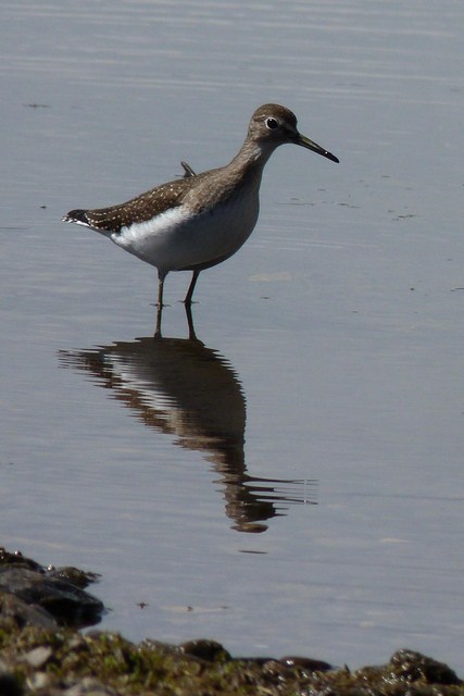
Curious
Onlooker at Neversink
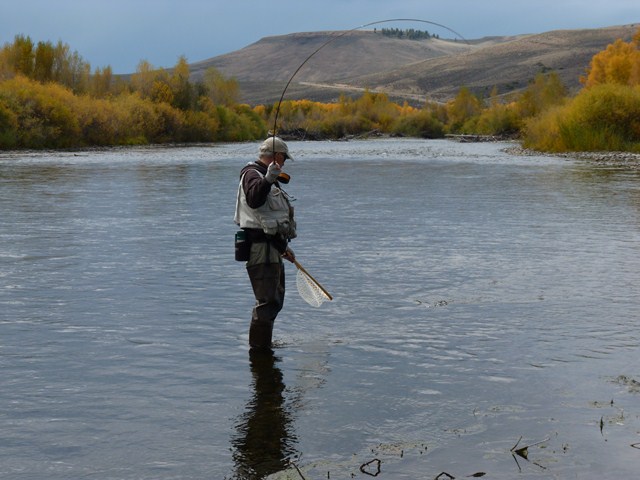
Although the river was gorgeous, the sun stubbornly refused to make an appearance and the day remained cold. Having caught a good trout in this spot, whilst being passed by a cowboy chasing frantically after his herd who had stampeded by us earlier, we headed up to the area below the reservoir dam.
It proved to be a frustrating day. Although the large fish were visible in the crystal clear water below the dam, they stubbornly refused to bite, despite being offered the full menu of Phil's fly collection. Finally a small one found something to its liking but that was his lot. Nobody else seemed to be having any more luck.
We decided, as dusk fell, to head downstream to a camp ground about four miles away, where we'd spotted a couple of caravans on our way up the mountain. On arrival, these proved to be trailers housing the maintenance crew, the camp ground being closed for the season and locked.
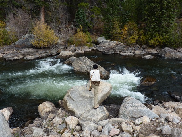
Fishing
the Taylor River as cattle stampede by.
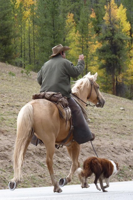
Anyone
seen any cattle?
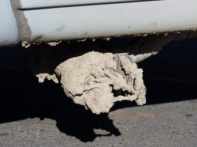
Where
Harvey's plumbing used to be before the mud.
We had feared that this might be the case, as our information said they should have closed on Labour Day, a couple of weeks earlier, yet spotting the trailers had misled us. Never mind, the camp ground up at the reservoir itself was open until the 1st of October. We turned around and Harvey made the four mile climb back up to the dam and its reservoir. It didn't really matter, as we planned to take the Cottonwood Pass beyond the reservoir to continue our trip through Colorado. We arrived at the camp ground in the gloom to find the gate firmly locked, then we looked east and saw the daunting mountains through which the pass would lead. Hmm, it was time for plan B.
By now it was dark, we were pretty fed up with the Taylor River. We had no choice but to make the tortuous journey downhill through the muddy roadworks towards Gunnison, if we weren't heading over the Pass. At least the downhill journey proved quicker at that time of night, with only one poor flagger still working in the dark and freezing cold as the road crew put up reflective cones, allowing any travellers risking the trip at night to at least have a chance of staying on the mud road. By the time we reached the camp ground where we'd spent the previous night, luckily finding one of its five sites vacant, it was definitely time for a beer. So much for the promise of the Taylor River, we certainly weren't venturing through those roadworks again!
By now we were also in need of more effective mouse-traps and as we passed through Gunnison again the next day, picked up two of the humane variety in the hardware store. We'd tried the murderous spring type of trap which were mostly effective at bruising fingers. Next we'd diversified into fancy spin traps, which although fatal, meant you didn't actually have to see the results of your murder. Mice resolutely refused to enter these fancy devices, despite the alluring scent of peanut butter. Finally, we realised that the most effective trap we'd used was the humane one which had consistently caught mice, even when stored, unbaited in a cupboard. Two humane traps were installed, baited with peanut butter in the hopes that we'd soon get to meet our secretive stowaway.
We'd had mixed reports of the Arkansas river. One guide told us it was the best river in Colorado, others had said it was just "OK" but we read the latest fishing reports, which appeared good and decided to head to the town of Salida, located on the river, to speak to locals and find out more.