|
Georgia
27th - 30th May 2008
|
|
We decided, if we were really to see America
during our road trip, we would have to stay off the Interstate and travel on
the smaller roads. Our other plan was to do about 200
miles a day, to arrive at our next camping destination around lunchtime,
giving us time to explore. We left Green Cove Springs on the
very scenic route 16. The magnolia were in full bloom and
often we were seemingly driving down a magnolia roofed tunnel.
|
|
We'd selected route 441 for our trip across
Georgia and a first camping destination at the General Coffee Georgia State
Park, famous for its heritage farm, demonstrating old-time farming
techniques and for being the home of the threatened Gopher Tortoise and
Indigo Snake.
Once we'd set up camp, we hit the hiking
trails in the park, first taking the nature trail to the heritage
farm. There were no sightings of the endangered wildlife
but we chanced upon a group of Armadillos, who seemed unconcerned by our
presence. After visiting the not-so-wild-life at the
Heritage Farm museum and the beautiful fishing pond, we decided to follow a
second trail, which passed "many scattered tortoise
colonies". Again we had no luck with the wildlife and on
returning to our campsite we glad of the excellent shower and laundry
facilities the campground had to offer.
|
|
|

|
|
|
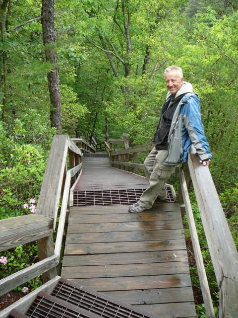
Wild and not-so-wild life
at the General Coffee State Park
|
|
We'd really enjoyed the first day of our road
trip, when the biggest stress had been trying to find the local Walmart to
pick up supplies!
The next day we continued along route 441,
enjoying the scenery until we reached Lake Sinclair, where we stopped in the
not particularly thrilling campground at the National Forest Recreation
Area. We were glad of the on-site electricity and our
air-conditioning as we were rained in through an evening thunderstorm.
Now we were climbing into the Georgia Blue
Ridge Mountains, bound northwards towards North Carolina. By a
spot of incorrect navigation we passed through the pretty and historic town
of Madison.
|
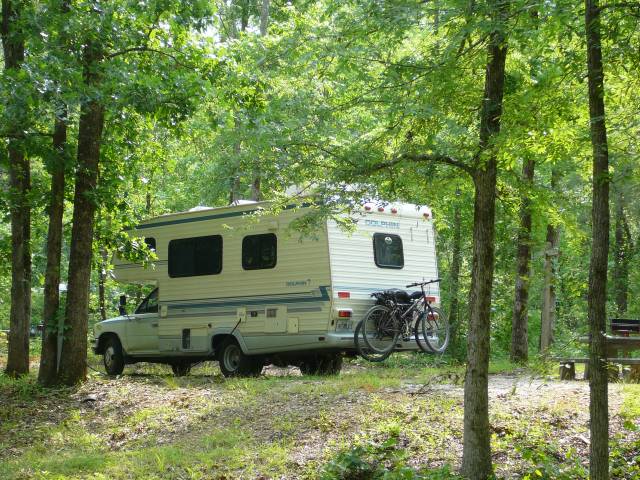
Harvey Deep in the Woods
|
|
En route we made a stop for refueling Harvey and
for a crew bathroom break. Two almost identical elderly
sisters ran the petrol station and pointed us in the direction of the
bathroom. Christine quickly returned to the kiosk after
finding herself plunged into darkness, to enquire about the possibility of
light in the restroom. Apparently the ladies had forgotten
to change the bulb and after some debate, reluctantly agreed to allow
Christine to use "their" bathroom and handed over the
key. Unsure about this dubious honour, Christine promptly
took the key, unlocked and walked into the cleaning closet before being
rescued and pointed in the right direction.
|
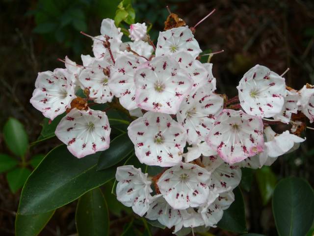
Mountain Laurel in Bloom at
Tallulah Gorge
|
|
Refreshed and refueled we headed for Tallulah
Gorge State Park, where the navigator and new GPS had their first minor
disagreement. Eventually we found our goal and arrived at
the Gorge, one of the oldest geological features in North
America. Over thousands of years, the Tallulah river had
eroded the rock into a 1000 foot deep chasm, more than two miles
long. The river dropped almost 600 feet before joining the
Chattooga River, with five major waterfalls in its
path. The town of Tallulah Gorge had been a popular
holiday destination once the railroad was built but was largely destroyed in
a major fire many years before our visit.
The State Park offered a trail along both
sides of the gorge, with impressive views along the way. At one
end the two sides were joined by the highway bridge over the
gorge. To cross the other end of the gorge was more tricky,
involving descent and ascent of 1003 steps and a walk over the Hurricane
Falls narrow suspension bridge. Christine and Phil
were the only people on the bridge when they crossed but, needless to say, a
naughty little boy wanted to try to make the bridge sway, despite his fear
of heights.
|
|
How many steps?
|
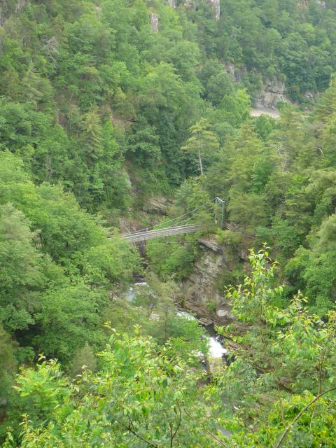
Hurricane Falls Suspension
Bridge.
|
|
We continued north on 441, further into the
mountains, in search of our next destination, Black Rock Mountain State
Park, where we planned to spend the night. Despite apparently
lying on a road close to 441 on the map, the park proved tricky to find,
with several unmarked junctions along the way.
Harvey huffed and puffed his way up the steep and narrow
lanes. After making a wrong turn and ending up on a dirt
track, we retraced our steps and tried to ascertain our location on the
map. On being asked where we were, the navigator's
response was that she was unsure but we definitely lay right on the Eastern
Continental Divide. "How do you know?" she was
asked. The big sign just outside the passenger
window was a good clue!
|
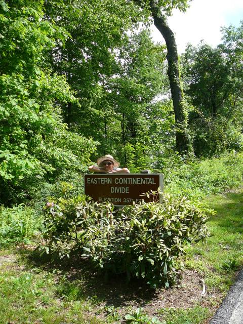
So where exactly are we?
|
|
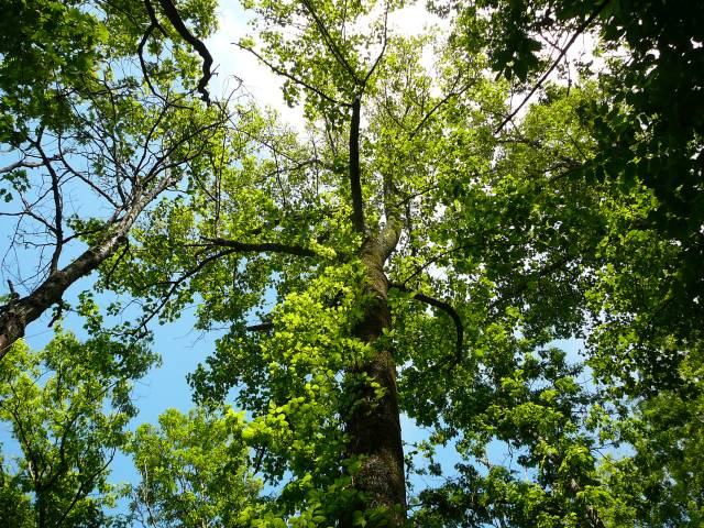
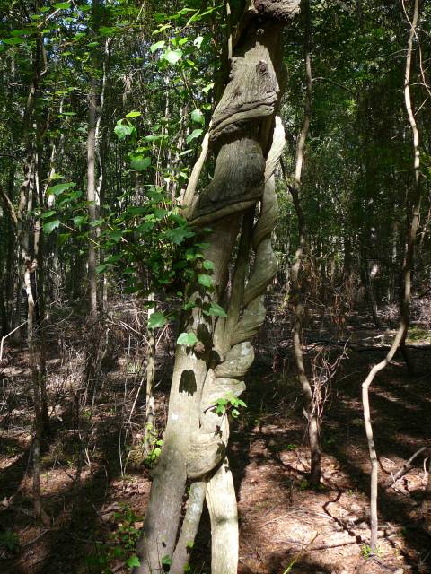
Beautiful trees at Black
Rock Mountain.
|
We eventually arrived at the campground and
selected our beautiful campsite, with its own picnic site, completely
shrouded in blooming rhododendrons. We set out to explore for
the rest of the day. We had already hiked quite a way at the Tallulah
Gorge and now found ourselves on pretty strenuous trails through beautiful
woodland.
As in the sailing world, it seemed that
pot-luck dinners were common in the camping world and we were invited to one
at the campground office. However, by the time we arrived back
at our home campsite after our hike, we were just too tired to be sociable!
|