From the Border via Tok to Valdez, Alaska, USA
21 – 25 July 2014
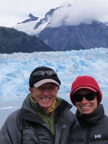
Finally, we'd made it. Alaska, the 49th US state chronologically for both us and Alaska. Only 5151 miles from where we'd started driving in Florida three and a half weeks earlier. What now?
Not a lot of Alaska was accessible by road and what roads there were led tourists basically in a circuit, Tok to Anchorage, Fairbanks and then back to Tok. Detours to the coastal port of Valdez and the Kenai Peninsula are definitely of the there and back again type, unless you decide to take the pretty pricey ferry back to the lower 48 states. Our main decision was clockwise or anticlockwise....
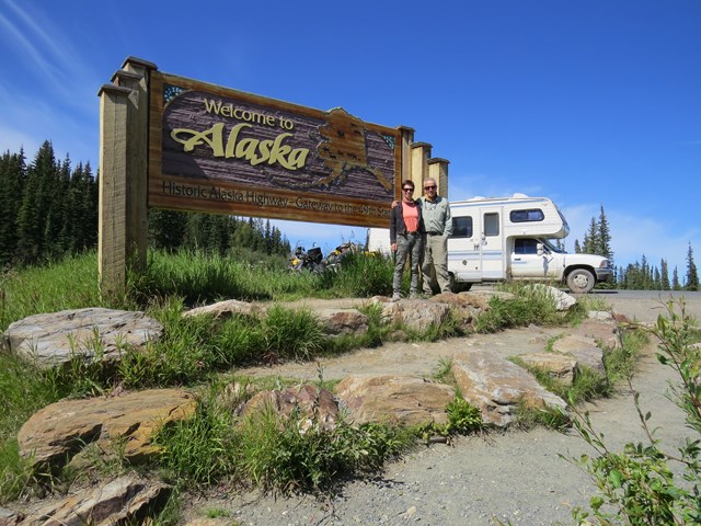
Made
it, well done Harvey!
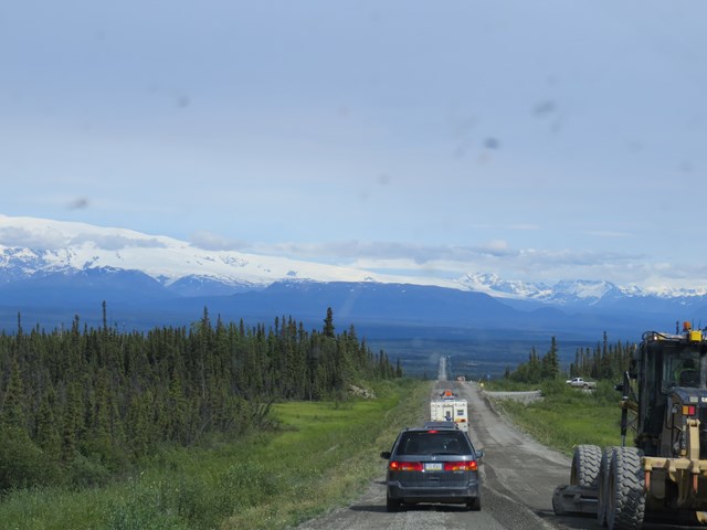
We headed, still on the Alaska Highway, from the border at High Cache in a north westerly direction, bound for Tok. We were both quite weary after the gruelling rough road driving in the latter part of the Yukon and were relieved to see beautiful, smooth tarmac stretching before us, for a while at least!
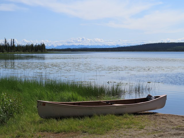
We decided to camp at the Tetlin National Wildlife Refuge and selected the invitingly named Deadman's Lake Campground, which was both beautiful and free of charge. We stretched our legs, strolling down to the lake and spotted our first Alaskan wildlife, mosquitoes! In fairness the mosquitoes weren't our only harrassers, as a family of jays decided we were most curious to look at while we relaxed.
Deadman's
Lake
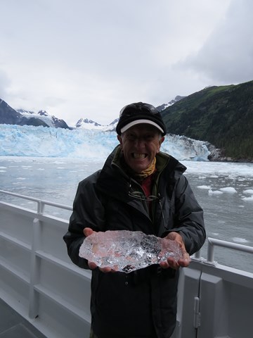
No,
not a dead man, just one expressing his relief at finally arriving
in Alaska.
About
that wildlife......Did somebody mention bears?
The evening found us entertained by a member of the local Athabascan tribe, also a park ranger, who gave us a fascinating insight into the local history of the tribe and their lifestyle. She told us about the tradition of “Potlatch”, a tribal gathering to remember members who have passed on or to celebrate achievements by the living. The person holding the “Potlatch” is expected to invite certain tribe members, who can number up to 200 at a time and then is responsible not only for catering for their every need for the three day celebration, but also for handing out gifts to the many attendees. Our friendly and obviously generous hostess told us that the Potlatch she'd held, to remember her late mother and grandmother, took two years to prepare, as hundreds of gifts had to be handcrafted and food had to be hunted.
After an informative visit to the information centre in Tok, we decided upon a clockwise tour of Alaska's highways and so made a turn to the south west towards Valdez.
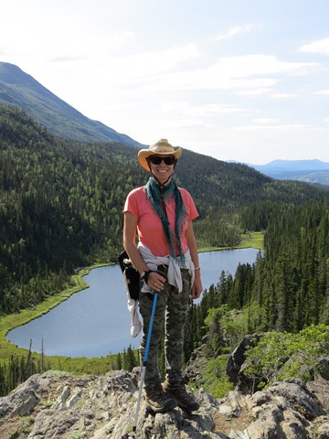
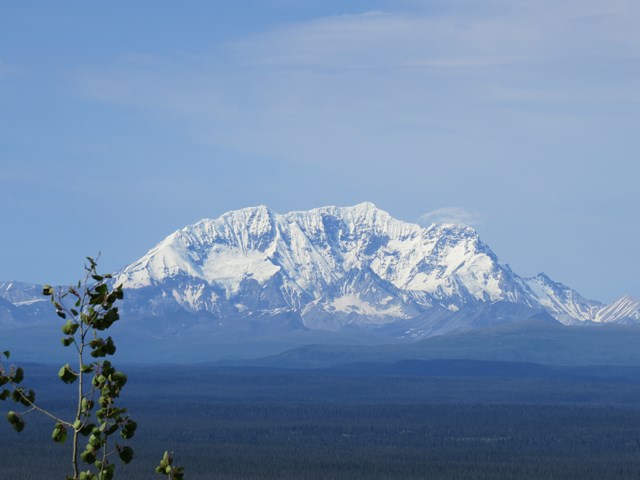
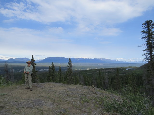
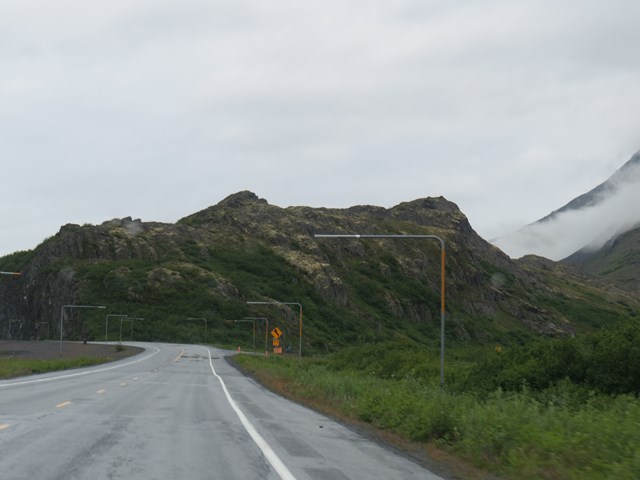
To reach Valdez we had to skirt around Wrangell-St. Elias National Park, the largest in the USA, as large as six Yellowstone Parks. The park contained the Wrangell Mountain range including nine of the sixteen highest mountains in the country. However it was a wilderness and the one “road” which led 61 miles into the interior of the park, almost reaching the old mining town of McCarthy, was actually more of a converted, disused mining railway than a road. The warnings of rough road conditions and the threat of old railroad spikes frequently being unearthed and wrecking tyres helped us to decide only to drive as far as Chitina, situated on the western edge of the park. The ranger recommended a hike near the Liberty Falls campground on the Edgerton Highway, so off we set.
Edgerton
Highway roadworks
Liberty
Falls Trail
We found the Edgerton Highway to be not in much better shape than a disused railroad, as a long stretch at the beginning was little more than dirt, as the roadcrew worked to resurface it. Eventually a grubby Harvey made it to Liberty Falls, where we were lucky to snag the very last of the six campsites, a gorgeous one at that, right on the riverbank.
The hiking boots were dug out and we tackled the relatively short but challenging hike up to a stunning viewpoint. The trail was lined with wild blueberry bushes but as berries and bears were scarce, whilst bear poo was not, we decided that the bears had already had their fill from that area!
After the fire bans in Canada, we were delighted to make use of a pile of firewood somebody kindly left behind and enjoy our first campfire in Alaska. The smoke helping keep the mosquitoes at bay.
The next morning dawned gloomy, cold and damp. We drove up to the small town of Chitina, a good spot to watch the locals at work harvesting salmon. We watched, fascinated, as the intrepid souls, clad in waterproofs, entered the river up to their chests, dragging a large net, called a dip net, along the river bed in the hopes of scooping up some passing salmon, which were on their way up the river to spawn. While we watched, we were shivering in a bitter cold wind, in our warmest winter clothes. Phil decided he'd stick to fly-fishing!
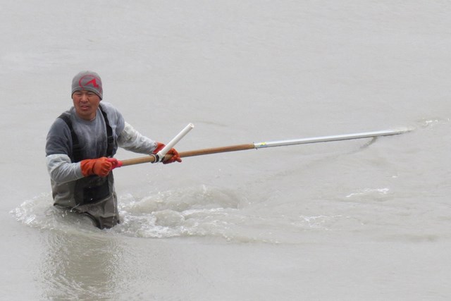
All
that effort, luckily he caught a fish!
Those
are mighty big snowposts!
Harvey's next challenge was to climb over Thompson Pass. By Colorado standards it wasn't a particularly high pass at only a couple of thousand feet, yet the size of the snowposts at the top was quite humbling!
Worthington Glacier lay close to the highway near the pass and was easy to visit on the way.
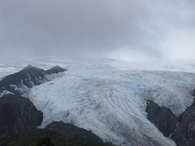
Worthington
Glacier
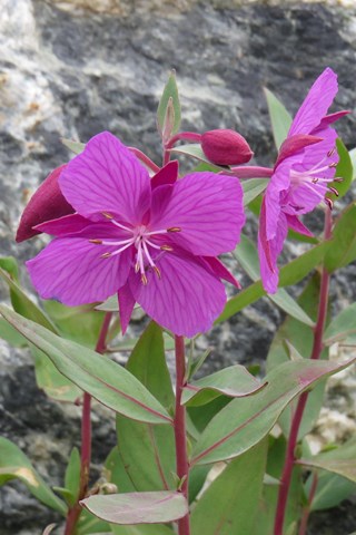
A
welcome splash of colour in a bleak landscape
It had been suggested that in Valdez we stay at the campground at Allison Point, actually 11 miles from the town, across the estuary. This was a good spot to fish for salmon returning to the hatchery there. This was evidenced by the large numbers of anglers spinning from the shore. However, the immediate mosquito attack on exiting Harvey to check it out, helped us to decide to stay at a commercial campground right in town.
Our main purpose for visiting Valdez was to take a boat trip to Meares Glacier, which was arranged for the following day. Staying in town would give us a chance to take a walk around town and see the highlights. We were surprised to find a large number of bunnies, the domesticated type, roaming around the town!
We learned that Good Friday is probably a day to avoid the town of Valdez. In 1964 on that day a 9.2 magnitude earthquake lasting more than four minutes caused most of the town's waterfront to be washed away. In 1967 fifty two buildings were moved four miles to more stable ground.
The relocated town endured another Good Friday disaster in the shape of the holing of the Exxon Valdez tanker on Bligh Reef which caused a massive oil spill.
Valdez
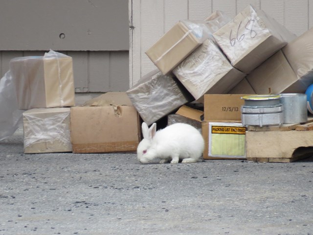
What
is with all the rampaging bunnies?
Early next morning we were aboard our boat, Valdez Spirit, having made friends with a lovely dutch family on the way. We enjoyed the company of Wiert, Gabrielle, Bouke and Anna throughout the day whilst we got aquainted with much of Alaska's abundant sealife and striking scenery. Sightings included Harbour Seals, Stellar Sealions, Sea Otters, Humpback Whales, Dall's Porpoise and too many seabirds to even recall.
Our
new pals from Holland
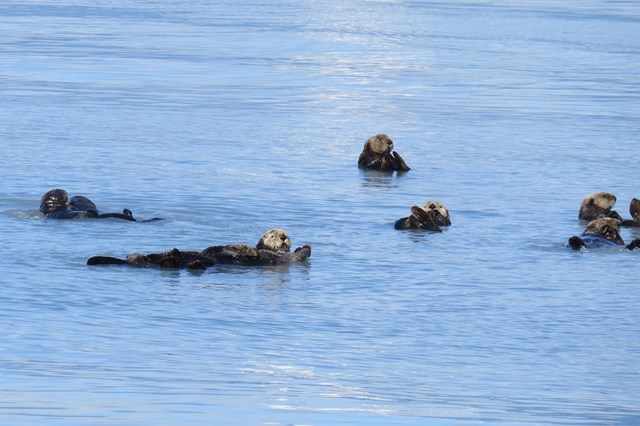
Sea
Otters doing their thing
On reaching Meares Glacier at the point where it reached the sea, our Captain shut down the boat's engines and we all waited patiently for the spectacle of “calving”, where large chunks of glacier would fall into the sea forming new icebergs. We were not disappointed to enjoy what the Captain described as the most active calving day he'd ever seen at that glacier. Huge chunks of ice fell while we watched, causing seabirds to take flight and our boat to rock in the waves they produced. The seals, however, seemed unconcerned, the waves perhaps rocking them to sleep on the floating ice where they were resting.
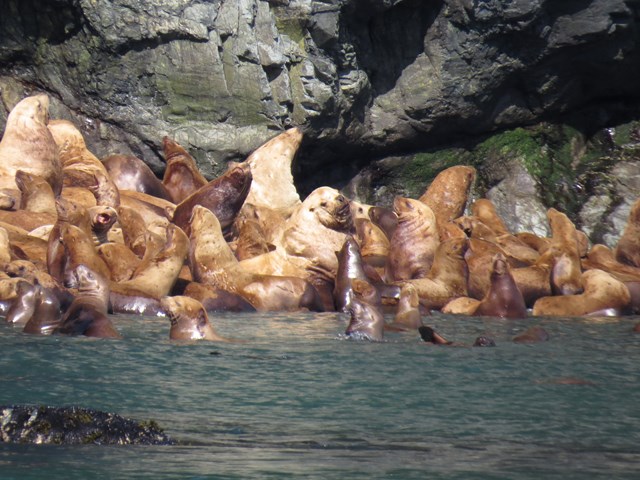
Stellar
Sealions
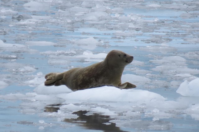
Harbour
Seal Chilling Out – literally!
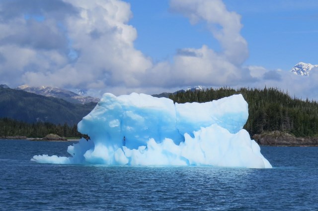
Our
first iceberg – glad we were on somebody else's boat!
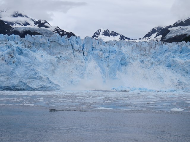
The
iceberg's birthplace, Meares Glacier calving.
Can
you get me a G & T to go with this?
On the return voyage to Valdez, we were blessed to encounter a large humpback whale with a calf, swimming in the calm waters of the bay. As they dived, the Captain was able to tell us exactly which whale it was and a little of her history. The whales could be identified by the unique white markings on the underside of the tail, seen as they dived, from a guide compiled by local scientists.
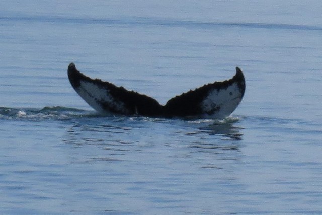
Humpback
Whale taking a dive
Next morning we were back on the Richardson Highway, retracing our steps as far as Glenallen, where we turned west towards Anchorage onto the Glenn Highway. It was here that we discovered the almond milk disaster which had occurred in our fridge. An almost full carton had tipped on its side, depositing its contents into the drawer below, which contained Christine's clothes. A trip to the laundry would be needed.
Undaunted we continued on the Glenn Highway. Phil had decided it was high time he had a fishing licence, as we passed numerous stocked lakes along the way. We spotted a small roadside lodge which sold licences and called in. Not only did they sell us the necessary licence they also offered Phil the opportunity to fish the creek on their land, so he didn't pass up the chance.
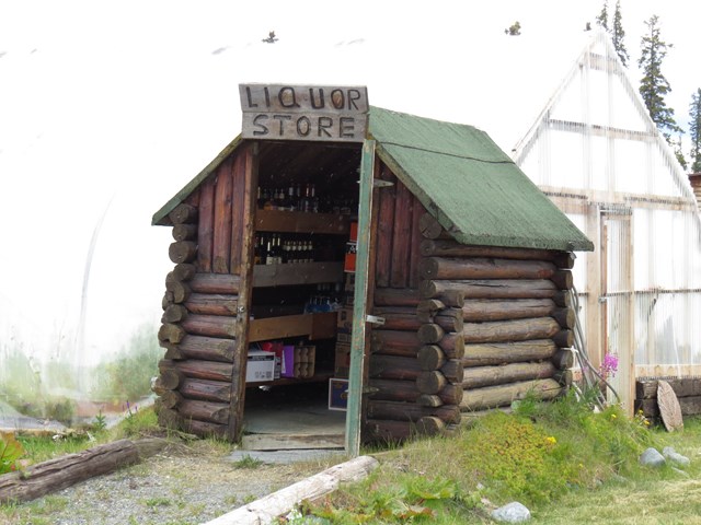
And
if you get thirsty while you are fishing.....
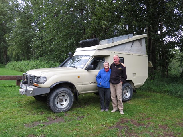
Erik
and Armgard with their rugged camper.
We reached the town of Palmer, north of Anchorage, by late afternoon and here our disorientation began. We chose a lakeside state campground about five miles out of our way, hoping there would be some good fishing. When we finally tracked the campsite down, our GPS having initially brought us around the back of the park, so we were on the outside of the fence looking in, we found it “closed for construction”. Never mind, we'd try the campground provided by the town of Palmer and entered the co-ordinates given into our GPS as we were now lost and had no map of the town. This time the GPS took us to a private house and by now we were eight miles out of town and almost out of gas. We were forced to double back to get some fuel. These things always happened with the fuel indicator on “E”!
Eventually with the aid of a couple of friendly locals we had stopped to ask for directions, we managed to track down the elusive park, which for some reason didn't seem to be signed at all. Relieved we took a spot in the almost deserted campsite. It seemed others struggled to find it too!
A few minutes later we noticed an intriguing looking Toyota based camper pull in nearby and headed over to meet our Austrian neighbours. We had thought our drive from Florida had been long, until Erik and Armgard told us they had driven all the way from the southern tip of Argentina as far north as Prudhoe bay, the most northerly point accessible by road on the American continent. They were now headed to the East Coast to ship their vehicle back to Europe. They gave us a tour inside their vehicle which didn't take long and made us realise that, although Harvey was compact for two, it was possible to survive for long periods of time in even more cramped conditions!
Next morning found us headed south from Anchorage on the Seward Highway.