Intracoastal Waterway
Charleston, South Carolina to Beaufort, North Carolina
16th - 22nd June 2004
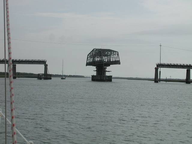
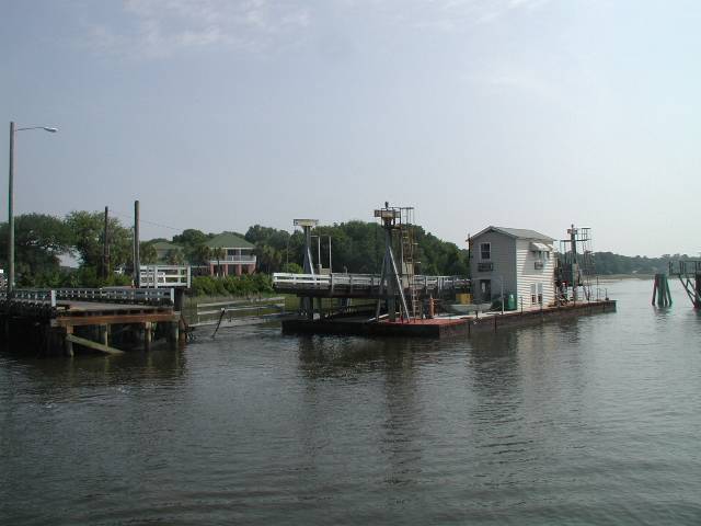
Our first ICW bridge - Ben Sawyer Bridge
As we left Charleston the countryside gradually became less and less developed, with just a few beautiful riverside properties along our route through the swamp. We saw dolphins and an alligator along the way. Later in the day, we figured we weren't going to make it to Georgetown that night and discussed where to anchor. As we debated, we suddenly found ourselves aground! The controlling depth in this area of the ICW was supposed to be 8 feet but with our six and a half foot draft we found ourselves resting on the bottom. We'd expected to run aground sometime in the ICW but had hoped it wouldn't be on our first day!
A Canadian sailing boat, Delfin Salar, was approaching from astern and as we stood on the back of the boat, wildly gesticulating that they shouldn't take the same track as us, they waved back and invited us to come over for a beer at the anchorage they were heading for. What greater incentive did we need for powering ourselves off the mud and getting underway again? After the day we'd had, we were glad of the opportunity to relax and get to know Jim and Ruth, who was actually Australian. The anchorage we selected was in the South Santee River, surrounded by swamp with no signs of habitation apart from a few crab pots. We enjoyed our drinks until we began to be attacked by large horseflies and fled back to Anju. On arrival, we found ourselves under attack again, this time by huge mosquitoes which had found their way inside while we'd been away. Finally after half an hour of frantic swatting, we retreated to the safety of our mosquito net-protected bed!
Pegasus tow-boat service!
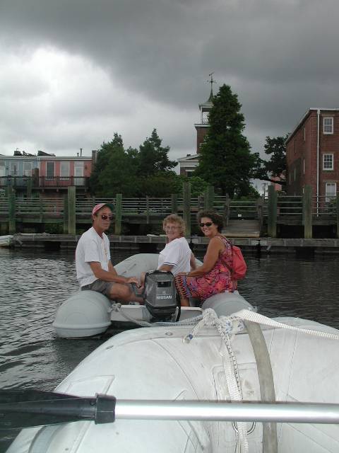
Next morning we were underway as soon as the mosquitoes went to bed, by about 7 am, but we were still the last to leave the anchorage. We headed to Georgetown, hoping to catch up with our friends on Pegasus. We were in luck and anchored beside them by about 10 am. They were leaving that evening, so we decided to go ashore with them straight away to explore. Lucky that we did, as they ended up towing our dinghy when our outboard decided to misbehave.
Georgetown was a peaceful three street town, home to a fleet of shrimp boats, so we had to seek out some fresh shrimp for lunch. Like Ebbw Vale, where we lived previously, Georgetown used to be a steel town but the steelworks was lying idle, awaiting purchase by a new company. The locals seemed divided on whether they wanted it to reopen or not.
After Mark and the two Janes left to make their passage offshore to Beaufort, we decided to treat ourselves and go ashore to a waterfront bar for a taste of local life. Phil's Caribbean shirt caused quite a stir and we met some interesting people. One couple even offered to take us to their home to use their shower (I didn't think we smelled that bad!). The town seemed to have a high proportion of New-Zealanders for some strange reason!
Next morning we headed north from Georgetown. The countryside we passed through was very beautiful and tranquil, small creeks running alongside abandoned rice fields and through the lush forest. It was wonderful, with birds, alligators, all kinds of wildlife and not many other boats. We passed lots of small marinas and anchorages where we wished we could spend some time to enjoy the wildlife, although the bugs would probably eat us alive!
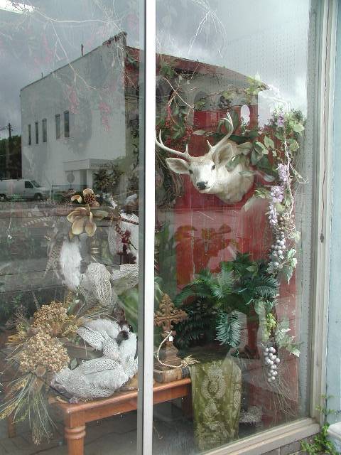
We just couldn't decide which dead animal/flower arrangement would look good on Anju!
Approaching Barefoot Landing on the ICW
Next morning we awoke on a slope. Anju was most definitely still aground! We'd put out an anchor from the bow the previous night and using that with our windlass and the power of the motor, we managed to power ourselves through the soft mud and get afloat again. We'd shared the dock with Wanderlust, a local boat owned by Horace and Sarah from North Carolina and we were happy to be following behind them, with their shallower draft. A couple of dodgy shallow sections were coming up that day and they'd agreed to call us up if they got into water too shallow for Anju.
The next challenge was an area called Lockwoods' Folly Inlet, where shoaling is a problem. We were glad to have Wanderlust in front of us, especially when our depth sounder read "0" below the keel the entire time! Although there are new floating buoys marking the channel, it was quite stressful as the waterway was busy on Saturday afternoon with all types of craft.
Sunset Beach Pontoon Bridge
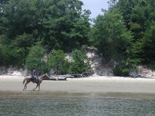
Our first real-live cowboy of the trip on the ICW!
Next morning we made an interesting backwards departure off the dock due to the influence of our friendly wind and tide! On the way up the ICW, we often had tide against us between the inlets and with 15 - 20 knots of NE wind on the nose, forward progress was hard work.
"What town are we in please?"
Finally around 11.30 we anchored in the pleasant anchorage behind Wrightsville Beach. We realised we had no idea how much anchor chain we had out, as most of the markers (we use cable ties to mark every 5 metres) had been lost in the Charleston-girder-fouling-incident! We kept letting out chain until we finally found a marker at 50 metres and then hauled all the chain back up again, marking it as we took it back in. We were glad we'd stopped as we both felt very tired and stressed. It is tiring moving all the time and covering new territory each day but we were under pressure to reach 35 degrees north before the start of hurricane season, to maintain our insurance coverage.
Our next challenge was to call home, as it was Father's Day, which you wouldn't think would be too difficult. After two hours of trying to call and speaking to numerous customer "service" agents at our mobile phone supplier, we discovered that we were outside the company's coverage area and although we could call via another phone company, they wouldn't allow overseas calls. Eventually we had to call Phil's niece Kate in California, ask her to call her parents in the UK, who rang Christine's Dad, who finally had to call us instead. Happy Father's Dad! Your present is the opportunity to make an international phone call at your own cost! If the Americans only realised just how poor their mobile phone services are compared to the rest of the world, I'm sure there would be trouble, especially if they worked out that most of the rest of the world isn't charged for receiving incoming calls!
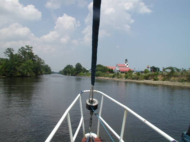
The next day was fairly uneventful until we encountered the surreal sight of a peacock chasing two llamas around a riverside town. It certainly made a change to the normal wildlife of ospreys nesting on marker buoys!
Later we passed an army firing range. Fortunately they were firing out to sea and not over the ICW, so we could continue on our way. We chatted to Pat and Marilyn on the trawler Manatee, who we kept encountering through the day and decided to head to the same anchorage in Swansboro that night. When we arrived, we also found our old chums Jim and Ruth on Delphin Salar again, so we all got together for drinks on Anju.
Despite its low rating in the pilot book, the anchorage was fine. However, we anchored in 4 metres of water, the tidal range was supposed to be 0.75 metres and when we got up next day we were in 0.6 of a metre, even though we'd circled and sounded out the depths before anchoring! Weird!
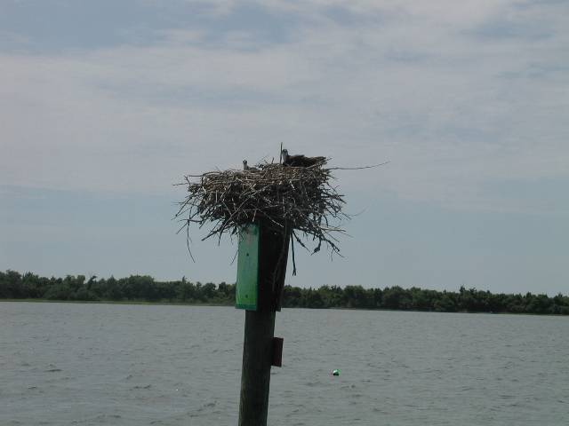
Those handy marker buoys make excellent Ospray homes!
Next day as we headed towards Beaufort, North Carolina, the weather turned scary as a thunderstorm approached. We were pleased to have Manatee still nearby when we considered whether to head for a nearby anchorage for shelter. They went through the entrance channel first and we able to tell us the depth in the 7 foot channel was now only five feet, so we had no option but to press on in the heavy rain and lightning.
As we passed Morehead City, we spotted three British warships, including the Sir Galahad and an aircraft carrier. We decided against dipping our ensign, the maritime sign of respect. This would then force them to respond by sending somebody out to do the same with their flag. We decided waving was less trouble for everybody. Manatee continued north up the ICW, so we said our goodbyes as we turned towards Beaufort inlet and made our way to the anchorage in the town, soon followed by Delphin Salar.